Swiss Travel System AG
Interactive map for travelling with the Swiss Travel Pass
The Swiss Travel Pass is the key to Switzerland's public transport network for visitors from abroad. With a single ticket, travellers can explore the whole of Switzerland by train, bus and boat. Tourists with a Swiss Travel Pass can use geOps' interactive map for seamless orientation, including panoramic routes, points of interest and continuous mobility by train, bus, boat and mountain railways.
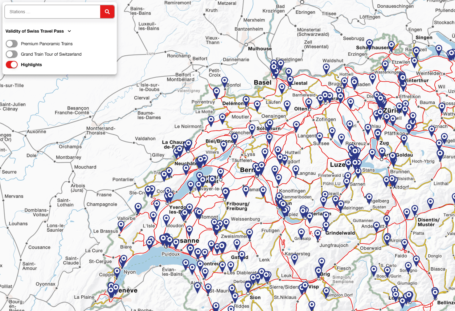
Map with panoramic routes and points of interest
The Swiss Travel Pass map on swisstravelpass.com is based on the tried-and-tested Trafimage system. It shows the Swiss rail, bus and boat network in a clear, cartographically consistent representation. Special attention is given to well-known panoramic routes such as the Glacier Express and Bernina Express, panoramic mountain excursions such as the Rigi or the Schilthorn, and the Grand Train Tour of Switzerland. For each route, it is clear at a glance whether it is included in the Swiss Travel Pass or whether a supplement is required. The map also includes points of interest such as sights, museums and viewpoints, making travel planning inspiring, eventful and interactive.

Orientation at a glance
The card is an indispensable tool for Swiss Travel Pass holders. It shows which connections and offers are included in the ticket at any time and also provides ideas for exciting excursions along the way. Instead of relying on printed maps or scattered information, travellers have all the relevant data clearly and reliably available on their mobile devices.

Looking ahead: rethinking digital travel companionship
The Swiss Travel Pass card shows how we are developing interactive map solutions for international travellers. In future, the card could be further developed through mobile integration, personalised tour suggestions or dynamic additional information.


«For our digital map solution, it was crucial to implement a technically sound, future-proof and low-maintenance solution. In geOps, we found the ideal partner for this. We were particularly impressed by the structured integration of the STS validity areas from the NOVA database. Thanks to the direct data transfer and the targeted adaptation of the data structure, we were able to significantly reduce our internal maintenance effort while ensuring sustainable data quality. We greatly appreciate the professional implementation, transparent project management and reliable, solution-oriented cooperation with geOps at all times.»
Gianluca Rossi, Project Manager Marketing Production, Swiss Travel System AG


